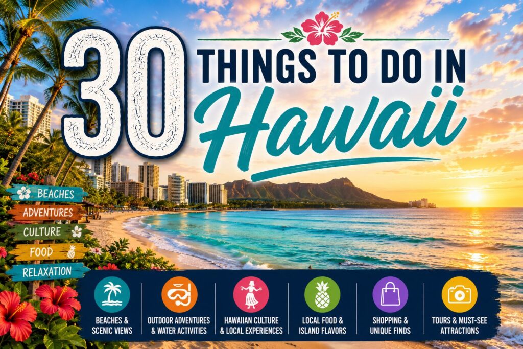
Hawaii is the only US state made entirely of islands. It is the only US state where coffee is commercially grown. It is the only US state that was once a sovereign monarchy with its own royal family, its own flag, and its own language – a kingdom that existed for nearly a century before the United States government helped overthrow it in 1893. And it is the only place on earth where Kilauea volcano’s ongoing episodic lava fountaining eruption – active continuously since December 23, 2024 – has now set the all-time record for the most fountaining episodes ever documented in a single eruption, breaking a record that stood for 40 years. Hawaii is not a uniform tropical destination. It is eight major islands with eight distinct characters, spread across 1,500 miles of Pacific Ocean, held together by geology and history and the specific spirit Hawaiians call aloha. Oahu has Pearl Harbor and North Shore shave ice and the most visited beach on earth. Maui has the Hana Highway and Haleakala at dawn and humpback whales from December through April. The Big Island has active lava and black sand beaches and Mauna Kea at 13,796 feet where the seeing is some of the clearest on earth. Kauai has the Na Pali Coast and Waimea Canyon and more green than your eyes know what to do with. I have been to Hawaii seventeen times across twelve years – every island, every season. This guide covers the 30 best things to do across the state, written in strict numerical order 1 through 30, with current 2026 data throughout.
For more US destination guides, visit Travel Destinations Plan. For city-specific Hawaii guides, read our things to do in Honolulu and our things to do in California.
Hawaii At a Glance: Quick Reference Table
| # | Activity | Island | Entry | Duration | Best For | Best Time |
|---|---|---|---|---|---|---|
| 1 | Pearl Harbor National Memorial | Oahu | Free (USS Arizona $1 per ticket) | 3 to 4 hours | History lovers, all visitors | Morning; book weeks ahead |
| 2 | Waikiki Beach and Diamond Head | Oahu | Beach free; Diamond Head $10/person | Half to full day | All visitors, first-timers | Morning before 9 AM |
| 3 | Hawaii Volcanoes National Park / Kilauea | Big Island | $30/vehicle (7-day) | Full day | All visitors; record eruption 2026 | Year-round; check episode status |
| 4 | Road to Hana | Maui | Free (road) | Full day | Scenic drivers, waterfall seekers | Weekdays; start before 7 AM |
| 5 | Na Pali Coast | Kauai | Free to view; boat/helicopter extra | Half to full day | Hikers, boat tour lovers | May to September by sea |
| 6 | Haleakala Sunrise | Maui | $30/vehicle (3-day); sunrise reservation $1 | 4 to 5 hours | Photographers, adventurers | Year-round sunrise reservation required |
| 7 | Snorkeling Molokini Crater | Maui | $90 to $130 (boat tour) | 3 to 4 hours | Snorkelers, marine life lovers | Morning year-round |
| 8 | North Shore Oahu – Haleiwa and Waimea | Oahu | Free | Half day | Surf lovers, foodies | November to February for big waves |
| 9 | Waimea Canyon | Kauai | $10/person or $25/vehicle | 2 to 3 hours | View seekers, hikers | Year-round; morning for clearest views |
| 10 | Hanauma Bay Snorkeling | Oahu | $25 per person (non-Hawaii residents) | 2 to 3 hours | Snorkelers, families | Morning; Tuesday closed; book online |
| 11 | Mauna Kea Summit and Stargazing | Big Island | Free (visitor center $30/vehicle park entry) | Half day | Stargazers, view seekers | Year-round at night |
| 12 | Polynesian Cultural Center | Oahu | $75 to $130 per person (package) | Full day | Families, culture seekers | Year-round |
| 13 | Kauai Helicopter Tour | Kauai | $300 to $450 per person | 50 to 75 minutes | All visitors, view seekers | Morning year-round |
| 14 | Black Sand Beaches – Punalu’u | Big Island | Free | 1 to 2 hours | Photographers, turtle watchers | Year-round mornings |
| 15 | Manoa Falls Trail | Oahu | $5 parking | 1.5 to 2 hours | Hikers, families | Year-round mornings |
| 16 | Whale Watching – Maui and Oahu | Maui / Oahu | $50 to $90 per person | 2 to 3 hours | Wildlife lovers, families | December to April |
| 17 | Waipio Valley Lookout | Big Island | Free | 1 to 1.5 hours | View seekers, photographers | Morning year-round |
| 18 | Kona Coffee Farm Tour | Big Island | $25 to $40 per person | 1 to 1.5 hours | Coffee lovers, culture seekers | Year-round |
| 19 | Kalalau Trail – Na Pali Coast | Kauai | $35 permit for overnight; $35 for full trail | 5 to 8 hours | Experienced hikers | May to September |
| 20 | Manta Ray Night Snorkel/Dive | Big Island | $75 to $120 per person | 2 to 3 hours | Wildlife lovers | Year-round at night |
| 21 | Front Street Lahaina / West Maui | Maui | Free to explore | 2 to 3 hours | Shoppers, history lovers | Year-round |
| 22 | Wailua Falls and Wailua River | Kauai | Free | 1 to 2 hours | Photographers, kayakers | Year-round |
| 23 | Diamond Head Crater Hike | Oahu | $10/person (non-residents); reserve online | 1.5 to 2 hours | Hikers, view seekers | Early morning |
| 24 | Jurassic Park Valley / Kualoa Ranch | Oahu | $55 to $195 per person (activity) | 2 to 3 hours | Families, movie location seekers | Year-round |
| 25 | Maui Ocean Center | Maui | $32.95 adults | 2 to 3 hours | Families, marine lovers | Year-round mornings |
| 26 | Napali Sunset Catamaran Cruise | Kauai | $135 to $175 per person | 3 to 4 hours | Couples, groups | May to September |
| 27 | Road to Hana – Waianapanapa Black Sand Beach | Maui | $15 day-use reservation | 1 to 2 hours | Photographers, beach lovers | Morning; reserve online |
| 28 | Hulopoe Beach – Lanai | Lanai | Free; ferry from Maui $30 each way | Full day | Beach purists, snorkelers | Year-round |
| 29 | Poipu Beach and South Shore Kauai | Kauai | Free | 2 to 4 hours | Families, swimmers | Year-round |
| 30 | Kalaupapa National Historical Park | Molokai | $350 guided tour only | Full day | History lovers, hikers | Year-round; book months ahead |
1. Pearl Harbor National Memorial
Island: Oahu, 9 miles west of Waikiki | Entry: Free to visit; USS Arizona Memorial $1 per ticket online | Duration: 3 to 4 hours minimum | Best time: Arrive by 7 AM; book tickets online at recreation.gov weeks in advance; closed Christmas and New Year’s Day
Pearl Harbor is the most visited historic site in the Pacific – the naval base attacked by Japan on December 7, 1941, in the strike that brought the United States into World War II. The attack killed 2,403 Americans in two hours, sank or damaged 18 naval vessels, and destroyed 188 aircraft. The USS Arizona alone lost 1,177 of its crew when her forward magazine exploded – more than half the total American deaths of the entire attack. The memorial structure built directly above the sunken battleship’s hull, where 900 of her crew remain entombed, is one of the most sobering spaces in the United States: a white concrete bridge shape spanning the mid-ship section of the wreck, with the ship’s rusted hull visible below through the water and oil still rising from the wreck more than 80 years after the sinking. Standing above the Arizona changes your relationship to the word “memorial” in a way that visiting the most well-photographed site in any history textbook does not prepare you for.
The Pearl Harbor Historic Sites complex covers four major attractions: the USS Arizona Memorial (by boat to the mid-harbor structure), the Battleship Missouri Memorial (where Japan’s surrender was signed on September 2, 1945), the Pacific Aviation Museum (with aircraft from the attack period), and the USS Bowfin submarine museum. Each requires separate admission and separate ticket reservations. A full visit to all four takes 5 to 6 hours. The USS Arizona is the mandatory first stop for any visitor with limited time – the boat ride to the memorial structure, the Wall of Names listing all who died in the attack, and the view into the water where the ship still lies make it the most specifically affecting 90 minutes available at any historic site in Hawaii.
The USS Arizona Memorial at Pearl Harbor, where 900 American sailors remain entombed in the sunken battleship and oil still rises from the wreck 84 years after the attack, is the most affecting single historic space in Hawaii and the one that most changes in character between seeing it in photographs and standing on the white concrete structure above the rusted hull looking down through the water.
Practical tips:
- Tickets for the USS Arizona boat tour sell out weeks in advance at recreation.gov – book as soon as your travel dates are confirmed, as walk-up tickets are not reliably available and the earliest morning boat departures sell first; the first boat departure at 8 AM has the most tranquil harbor conditions and the lowest crowd level at the memorial structure.
- The four Pearl Harbor sites (USS Arizona, USS Missouri, Pacific Aviation Museum, USS Bowfin) each require separate admission – the total cost for all four adults runs $80 to $100 per person beyond the base free entry; plan your time and budget allocation before arriving rather than making decisions at the visitor center under time pressure.
- The visitor center’s two documentary films (18 minutes and 23 minutes, shown continuously in separate theaters) provide the historical context that makes the memorial visit meaningful rather than simply architectural – watch both films before boarding the boat to the memorial, as the sequencing from film to memorial was specifically designed to build the emotional understanding that the structure then completes.
2. Waikiki Beach and Diamond Head
Island: Oahu, Honolulu | Entry: Beach free; Diamond Head State Monument $10/person non-residents (online booking required) | Duration: Half to full day combined | Best time: Beach before 9 AM for quiet; Diamond Head hike starting before 7 AM to finish before heat
Waikiki Beach is a 2-mile crescent of sand in Honolulu that receives more visitors per square foot than any other beach on earth – the most visited beach in the United States, the beach that established Hawaii’s global tourism identity in the early 20th century, and the beach that most visitors to Oahu spend at least some time on regardless of what else they have planned. The beach faces south, providing consistent 2 to 4-foot breaking waves produced by the deep water approaching the reef from the south – waves gentle enough for beginner surfers and children in the shorebreak but real enough to body surf. The Duke Kahanamoku statue at the east end of the main beach honors the Hawaiian Olympic gold medalist who introduced surfing to the world and is the most photographed landmark on the beach. Outrigger canoe rides, surfing lessons from beach boys, catamaran cruises departing from the beach, and the specific Waikiki atmosphere of a working resort beach that has been doing this for 100 years make it the right starting point for any Hawaii visit.
Diamond Head, the extinct volcanic crater at the eastern end of Waikiki, is an 1.8-mile round-trip hike through the crater interior to the 761-foot summit with 360-degree views of Honolulu, Waikiki, the south Oahu coastline, and on clear days the mountains of the Koolau Range rising behind the city. The trail gains 560 feet of elevation through a combination of natural path and constructed stairs including two interior tunnels and a 99-step staircase that brings you to the summit fire control station built in 1910. Online timed-entry reservations are required at gostateparks.hawaii.gov.
Diamond Head at 6:30 AM on a clear morning, when the Waikiki hotel towers are visible below and the south Oahu coastline stretches in both directions and the trade wind is blowing from the northeast and you can see the reef line offshore where the waves are breaking – this is the view that establishes Oahu’s geography in a way that no amount of beach time below provides, and the 1.8-mile round-trip hike takes 75 minutes from the parking area.
Practical tips:
- Diamond Head timed-entry reservations sell out days to a week in advance at gostateparks.hawaii.gov – book immediately when your Oahu dates are confirmed, and select the earliest available time slot (usually 6 AM or 6:30 AM) to hike in the coolest conditions with the best light on the surrounding landscape.
- The best surfing lesson experience in Waikiki for first-timers is with the beach boy operators who have been teaching on the beach for decades – Hans Hedemann Surf School and the Waikiki Beach Boys are the two most consistently cited operators, with 90-minute group lessons running $50 to $75 per person and genuinely high stand-up rates for first-time surfers on the soft boards used.
- The Kuhio Beach Hula Show (free, runs Tuesday, Thursday, and Saturday at 6:30 PM on the Kuhio Beach hula mound) is the most accessible free cultural performance in Waikiki – hula and Hawaiian music in the open air on the beach as the sun sets, with the torch lighting ceremony before the show.
3. Hawaii Volcanoes National Park and Kilauea
Island: Big Island, Hawaii | Entry: $30/vehicle (7-day pass) | Duration: Full day minimum; 2 days recommended | Best time: Year-round – park open 24/7; check USGS Kilauea episode status at usgs.gov/hvo before arriving; HVNP turns 110 years old August 1, 2026
Hawaii Volcanoes National Park on the Big Island is the most geologically active national park in the United States – and in 2026, it holds an eruption that has broken a 40-year world record. Kilauea volcano has been in ongoing episodic lava fountaining since December 23, 2024. On June 1, 2026, Episode 48 of the current eruption became the most episodic lava fountaining eruption ever documented on Earth, surpassing the 47 high-fountaining episodes of the famous Pu’u’ō’ō eruption that ran from 1983 to 1986. As of late June 2026, Episode 50 has completed (ending June 27 after 7 hours of fountaining), and Kilauea is currently at ADVISORY level between episodes – with the next episode expected based on magma reinflation patterns that USGS monitors in real time. The park is open 24 hours, 7 days a week, throughout all eruption phases. During an active episode, lava fountains reaching 650 to 1,300 feet are visible from paved overlooks along Crater Rim Drive. Between episodes, summit glow and steam are often visible at night from the same overlooks.
The park contains 335,259 acres from sea level to the summit of Mauna Loa at 13,678 feet. The main attractions beyond the eruption itself: the Kilauea Iki Trail (4-mile loop dropping onto the still-steaming 1959 eruption crater floor), Nāhuku (Thurston Lava Tube, open 8 AM to 8 PM, a 500-year-old lava tube accessible on a 0.3-mile loop), Chain of Craters Road (all 19 miles open to the Hōlei Sea Arch at the coast), Sulphur Banks, Steaming Bluffs, and the Puʻuloa petroglyph field. The Kilauea Visitor Center is currently closed for renovation through summer 2026; a temporary Welcome Center operates at Kilauea Military Camp from 9 AM to 4:45 PM. The park turns 110 years old on August 1, 2026 – a milestone being marked with special programming throughout the summer.
Kilauea in 2026 is in the most episodic lava fountaining eruption ever recorded on Earth – a geological event happening right now, on a Hawaiian island, visible from a paved parking lot inside a national park open 24 hours a day for a $30 vehicle fee, and the USGS posts real-time updates that let you monitor the eruption cycle before you arrive and time your visit to an active episode.
Practical tips:
- Sign up for the free USGS Volcano Notification Service at usgs.gov before your Big Island visit – the service sends email alerts when Kilauea’s alert level changes from ADVISORY to WATCH (the precursory phase before an episode begins), giving you advance warning to drive to the park for the next fountaining event.
- The Uēkahuna Overlook on the western rim of Kilauea Caldera is the primary eruption viewing point – a large paved parking area with a clear sightline into Halemaʻumaʻu crater where the active vents are located; arrive before 6 AM during active episodes to secure parking before the volume builds from 7 AM onward.
- The Kilauea Iki Trail (4-mile loop, 400 feet of elevation change, 2 to 3 hours) is the single best hiking experience in the park outside of an active eruption – the trail descends from the crater rim into the 1959 eruption crater floor where cracks still steam and the solidified lava lake surface crunches underfoot, and it operates regardless of current eruption status.
4. Road to Hana
Island: Maui | Entry: Free (road); individual site fees apply | Duration: Full day – 10 to 12 hours from Kahului | Best time: Weekdays; depart before 7 AM; drive east-to-west (Kahului to Hana direction)
The Road to Hana is a 52-mile highway from Kahului on Maui’s north shore to the small town of Hana on the island’s remote eastern coast, passing 59 bridges (most single-lane), more than 600 curves, 24 waterfalls visible from or near the road, rainforest, black sand beaches, bamboo groves, and the specific character of a Hawaiian landscape that tourism has not fully organized itself around. The drive itself is the experience – not Hana town, which is a small community of approximately 1,200 people with limited services. Waikamoi Nature Trail (a 0.75-mile loop through eucalyptus and native plants), Garden of Eden Arboretum, Puohokamoa Falls, Twin Falls, the black sand beach at Waianapanapa State Park, and the Pools of Ohe’o in the Kipahulu section of Haleakala National Park are the major stops on the route.
The Hana Highway demands respect – the single-lane bridges require yield protocols, the curves require constant braking, and the drop-offs on the ocean side require comfort with narrow roads above significant elevation. Two specific mistakes produce the worst Road to Hana experiences: starting after 9 AM (meeting the oncoming tourist vehicle stream head-on in the narrowest sections), and driving it as a round trip in one day (10 hours of driving the same road). The correct logistics: depart before 7 AM, drive the one-way Hana direction, spend the night in Hana, and return via the southern Piilani Highway if road conditions permit. If returning the same day, leave Hana by 2:30 PM to arrive back before dark.
The Road to Hana at 6:30 AM on a Tuesday, before the rental car queue has organized itself and the single-lane bridges have become a choreography problem, when the waterfalls at the roadside pullouts have no one else stopped at them and the bamboo grove at Waianapanapa has morning light coming through the canes and the rain is doing what it does on Maui’s windward coast – this is the road trip that produces the specific Maui response that makes people come back.
Practical tips:
- Waianapanapa State Park (the black sand beach at mile 32 on the Hana Highway) requires an advance day-use reservation at dlnr.hawaii.gov at $15 per person plus $10 parking – book this well in advance as the park manages capacity and day-use spots for non-camping visitors fill 2 to 3 weeks ahead during peak season.
- The Pools of Ohe’o (Seven Sacred Pools) in the Kipahulu District of Haleakala National Park at the end of the Hana Highway require the $30 Haleakala park vehicle fee and are a separate 30-minute drive past Hana town – currently accessible on a seasonal basis, so confirm current conditions at nps.gov/hale before planning Ohe’o as a Road to Hana stop.
- Pack food and drinks for the full day before leaving Kahului – the road has a few fruit stands, a Hana general store, and scattered restaurants but nothing resembling reliable midday food access, and the most common Road to Hana complaint is discovering that the fuel gauge and hunger hit simultaneously in the bamboo section with nothing for 20 miles.
5. Na Pali Coast
Island: Kauai | Entry: Free to view; boat tours $130 to $175; helicopter tours $300 to $450 | Duration: 3 to 4 hours boat tour; half day helicopter | Best time: May to September for sea access; year-round by helicopter or Kalalau Lookout**
The Na Pali Coast is a 17-mile stretch of Kauai’s northwest coast where the ridgelines of the Napali Mountains drop directly into the Pacific at heights of 3,000 to 4,000 feet – fluted green cliff faces carved by 5 million years of rainfall and wave action into the most specific Hawaiian landscape visible from the sea. The cliffs have no road access. There is no highway on the Na Pali Coast – the only ways to reach the interior valleys and the coastline are by boat from the south (May through September when the ocean is calm enough) or by helicopter year-round or by hiking the 11-mile Kalalau Trail (covered at activity 19). The specific visual impact of the Na Pali cliffs from a catamaran or zodiac boat – 4,000 feet of fluted green stone rising from the water directly above you while sea caves and sea arches open at the waterline and waterfalls drop from ledges – is the most compressed natural scale experience available in Hawaii.
The summer boat season (May through September) allows catamaran and zodiac tours from Port Allen on the south shore. The winter months (October through April) close the sea to Na Pali tours due to the swell patterns generated by North Pacific storms – during this period, helicopter is the only way to see the coast from the air, and the Kalalau Lookout at the end of the Kokee Road provides a ground-level distant view from 4,000 feet elevation. The zodiac (inflatable raft) tours go into the sea caves and closer to the cliff faces than the catamarans – higher adventure, wetter, physically demanding, and the most intimate available relationship with the coastline.
The Na Pali Coast from a catamaran at 8 AM in June, when the 4,000-foot fluted green cliffs are catching the early sun and the waterfalls are visible on the faces and the boat is below the cliff line looking up at the geological age of what is above you – this is the single most visually specific experience available in Hawaii, the image the state tourism board has been using since the first photographs were made here, and no photograph has yet been made that conveys the scale of what is above you when you are below it.
Practical tips:
- Book Na Pali boat tours through Blue Dolphin Charters, Holo Holo Charters, or Captain Andy’s Sailing Adventures (the three most established operators from Port Allen) at least 2 to 3 weeks in advance for summer departures – the 5-hour catamaran tours with snorkeling and continental breakfast/lunch at $135 to $175 per adult sell out on all operating days, and last-minute availability is rare.
- The zodiac (inflatable boat) Na Pali tours from Hanalei Bay on the north shore run earlier in the season (when swell permits) and go significantly closer to the cliff faces and into the sea caves than the catamaran tours from Port Allen – they are wetter, more physically demanding, and not appropriate for visitors with back problems or motion sickness, but produce the most intimate sea-level cliff experience available.
- The Kalalau Lookout at the end of Kokee Road (9 miles past Waimea Canyon State Park) provides a free ground-level view of the Na Pali cliffs from 4,000 feet elevation year-round and is the correct alternative for visitors who cannot access the coast by boat or helicopter.
6. Haleakala Sunrise
Island: Maui | Entry: $30/vehicle (3-day pass); sunrise reservation required at $1 per vehicle | Duration: 4 to 5 hours including drive from Maui resorts | Best time: Year-round – reservation required; arriving before sunrise mandatory**
Haleakala is a 10,023-foot dormant volcano on Maui whose summit sits above the cloud layer on most mornings, providing a sunrise view from inside or above the clouds with the volcanic crater visible below the summit rim and the islands of the Big Island, Lanai, and Molokai visible in the distance. The crater is 7 miles long, 2 miles wide, and 2,600 feet deep – not technically a crater (erosion created it, not volcanic collapse) but visually one of the most dramatic high-altitude landscapes in the United States. The National Park Service manages the summit visitor area and requires advance sunrise reservations through recreation.gov from 3 AM to 7 AM daily – the reservation system opened for the first time in 2017 and is now the most important logistics piece of any Haleakala sunrise visit.
The drive from sea level to the 10,023-foot summit takes 1.5 to 2 hours from Wailea or Kaanapali on roads that switchback continuously through cloud forest, subalpine shrubland, and the specific arid moonscape of the upper summit. Arriving at the summit in darkness – the parking areas fill before 5 AM on busy mornings even with the reservation system – and then watching the sun clear the eastern horizon from above the cloud layer below is the specific Haleakala sunrise experience that cannot be replicated from any other publicly accessible summit in Hawaii. Charles Lindbergh chose to be buried on Maui partly because of this view. Mark Twain called the Haleakala sunrise the most sublime spectacle he had ever witnessed. Both men were correct.
Haleakala at sunrise – standing at 10,023 feet above sea level in temperatures 30 degrees colder than the beach you left 2 hours ago, watching the sun clear the horizon from above the cloud layer that sits below you in the crater basin, with the islands of the Pacific visible on three sides – is the most specifically vertical Hawaii experience available and the one that most accurately demonstrates what it means to be standing on the summit of a shield volcano in the middle of the Pacific Ocean.
Practical tips:
- Sunrise reservations at Haleakala are released online at recreation.gov 60 days in advance at midnight Hawaii Standard Time – set a calendar reminder for exactly 60 days before your intended sunrise date and be at the booking page at midnight, as the most popular dates sell out within minutes of release.
- The drive to the Haleakala summit takes 1.5 to 2 hours from Wailea and 2 to 2.5 hours from Kaanapali – the standard mistake is underestimating the drive time and arriving at the summit after the sunrise begins; depart at least 2.5 hours before sunrise time (which varies by month) regardless of where you are staying on Maui.
- Bring layers for the summit that are significantly warmer than the Maui beach weather suggests – the summit temperature at sunrise ranges from 30 to 50 degrees Fahrenheit year-round with wind chill adding further cooling, and visitors in shorts and t-shirts from the beach are the most common form of preventable misery at the Haleakala summit.
7. Snorkeling Molokini Crater
Island: Maui, 3 miles offshore from Maalaea Harbor | Entry: $90 to $130 per person (morning snorkel boat tour) | Duration: 3 to 4 hours | Best time: Morning departures between 6 AM and 7 AM for the clearest water before afternoon wind
Molokini is a partially submerged volcanic crater 3 miles off the southwest coast of Maui, forming a crescent-shaped rim that emerges 160 feet above sea level and creates a sheltered lagoon on the inner face. The lagoon’s protected position eliminates the surge and current that affect most Maui beach snorkeling and produces visibility that reaches 150 feet on optimal mornings – the clearest water accessible to a snorkeler without open-ocean exposure anywhere in the Hawaiian islands. The crater hosts more than 250 fish species and is one of Hawaii’s 11 State Marine Life Conservation Districts. The inner wall drops 70 feet to a sand floor with garden eel colonies, Hawaiian green sea turtles, moray eels, and the specific density of reef fish that a protected crater environment with no shoreline land impact produces. The outer wall, accessible to divers and advanced snorkelers on half-day charters, drops to 300 feet and is a different marine environment entirely.
Morning snorkel charters depart from Maalaea Harbor between 6 AM and 7 AM and return by 11 AM or noon. Afternoon departures (11 AM to 3 PM) encounter increasing trade wind chop that reduces the visibility and increases seasickness risk on the 30-minute boat crossing. The standard Molokini morning tour includes two snorkel stops – Molokini inner wall and a second spot, often Turtle Town off Makena where green sea turtle encounters are near-guaranteed. Gear is included. The clearest water and the most marine life activity is in the first 90 minutes inside the crater, before the sun rises high enough to change the light quality and before afternoon boat traffic increases.
Molokini Crater’s protected lagoon at 8 AM on a calm morning, when 150-foot visibility lets you see the full 70-foot depth to the sand floor and the moray eels are in their crevices and the Moorish idols are moving in schools through the reef and a green sea turtle cruises past at eye level – is the clearest, most marine-life-dense snorkeling experience available in Hawaii without a boat trip to an outer reef.
Practical tips:
- Book Molokini morning snorkel charters at least 1 to 2 weeks in advance from operators including Trilogy Excursions, Pacific Whale Foundation, and Kai Kanani Sailing – the Kai Kanani departure specifically launches from Makena Beach rather than Maalaea Harbor, cutting the crossing time to 10 minutes versus 30 minutes and providing significantly calmer conditions for seasickness-prone visitors.
- Bring or rent an underwater camera – Molokini’s 150-foot visibility produces the best snorkel photography available in Hawaii, and renting or purchasing a waterproof camera mount for your phone produces reliably better results than disposable cameras at above-water clarity depths.
- The Pacific Whale Foundation operates Molokini charters as a non-profit marine research organization and uses every charter as active research data collection – the marine naturalists on board provide substantively deeper marine biology commentary than commercial operators, and the ticket price directly funds Hawaiian marine conservation research.
8. North Shore Oahu – Haleiwa and Waimea Bay
Island: Oahu, 1 hour north of Honolulu | Entry: Free | Duration: Half day | Best time: November to February for the Eddie (big wave) and Pipe Masters; summer for swimmable calm water
The North Shore of Oahu is the winter surfing capital of the world – the 7-mile stretch from Haleiwa to Sunset Beach where the Banzai Pipeline, Waimea Bay, Sunset Beach, and Rocky Point produce the largest rideable waves on earth from November through February when North Pacific swells hit the shallow reefs at 20 to 30-foot face heights. The Triple Crown of Surfing (Pipeline Masters, Haleiwa Pro, and Sunset Pro) runs November through December annually and is the most prestigious surf competition calendar in professional surfing. Waimea Bay hosts the Eddie Aikau Invitational, run only when waves reach 30 feet – it has been held 11 times since 1984. In summer (May through September), the North Shore becomes exactly the opposite: a calm, clear bay with 1 to 2-foot water ideal for swimming, snorkeling, and stand-up paddleboarding.
Haleiwa town itself is the most specifically Hawaiian town on Oahu’s tourist circuit – a former plantation community now occupying a walkable main street of surf shops, art galleries, shave ice stands, restaurants, and the specific character of a real community that receives visitors without organizing itself entirely around them. Matsumoto Shave Ice at 66-087 Kamehameha Highway has served shave ice from the same building since 1951 and is the most visited single-item food stop on the entire North Shore. The banana-flavored shave ice with azuki beans at the bottom, eaten on the front step in the North Shore sun, is the most specific Oahu food experience available outside of a plate lunch.
The North Shore on a December morning when the Eddie is running, the parking lots on Kamehameha Highway have been closed since 5 AM, 10,000 people are lined along Waimea Bay watching 30-foot waves carry humans across 500 feet of water at speed, and the sound of the crowd when a successful ride completes is the specific roar that the North Shore produces for this specific combination of human achievement and oceanic scale – this is the most dramatic free spectator event in Hawaii and one of the most exciting athletic events on earth.
Practical tips:
- The Eddie Aikau Invitational runs only when Waimea Bay waves consistently reach 30 feet measured by NOAA buoys – the waiting period for a hold is typically December through February, and the event can be called with as little as 12 hours’ notice; following the Quiksilver Eddie social media accounts provides the most reliable advance notification.
- Matsumoto Shave Ice (66-087 Kamehameha Highway, Haleiwa) has lines that build from 10 AM onward on weekdays and from 9 AM on weekends – arriving at 9 AM on a weekday is the optimal balance of fresh ice and manageable wait time, and ordering the condensed milk pour addition changes the texture in a way that makes the standard version seem underdressed.
- North Shore ocean swimming in summer (May through September) is appropriate at Waimea Bay and Sunset Beach when the water is calm – during winter months (November through April) the North Shore surf is lethal for non-surfers and the current beach lifeguards will pull you from the water for attempting to swim.
9. Waimea Canyon
Island: Kauai | Entry: $10 per person or $25 per vehicle | Duration: 2 to 3 hours | Best time: Year-round; morning for the clearest views before afternoon cloud buildup; September to May for the most visible waterfalls**
Waimea Canyon is a 14-mile-long, 3,600-foot-deep canyon in the western interior of Kauai – carved by the Waimea River over millions of years through the layered basalt of the island’s volcanic geology and producing a color sequence of red, brown, orange, and green that has led multiple writers to compare it to the Grand Canyon. Mark Twain called it the Grand Canyon of the Pacific, and the specific visual combination of eroded red lava walls, white waterfalls dropping across vertical basalt faces, and the green of the native plant communities on the accessible ledges and crater floor produces a landscape that no other Hawaiian island offers. The canyon is accessible from the Waimea Canyon Drive (Highway 550) that climbs from sea level at Waimea town to 3,600 feet at the Kalalau Lookout in 9 miles, passing multiple overlook pullouts with different perspectives on the canyon geometry.
The two best viewpoints are the Waimea Canyon Lookout at mile 10 of Highway 550 (the standard stop, with a view down the full canyon length to the Pacific visible at the far end) and the Puu Hinahina Lookout 1.5 miles further up the road (a higher elevation perspective that shows the canyon width and the relationship to the Kokee Plateau above). The canyon is most visually dramatic in the morning when the sun comes from the east and illuminates the red basalt walls in full direct light – afternoon visits produce flat, washed-out colors. In wet weather, additional waterfalls appear on the canyon walls that are not visible in dry conditions.
Waimea Canyon at 8 AM on a clear morning, when the sun is hitting the red basalt walls from the east and a waterfall on the far side of the canyon is visible for its full 2,000-foot drop and the Pacific Ocean is a silver sliver at the canyon’s far end – this is the Kauai landscape that appears in every Hawaii tourism publication and that most Kauai visitors reach by driving 45 minutes from the resort areas on the south and east coast of the island.
Practical tips:
- Waimea Canyon is most visually rewarding in the morning before 11 AM – the afternoon cloud layer that develops over the canyon interior from noon onward produces a washed-out, mist-obscured view that significantly reduces the color contrast between the red basalt walls and the surrounding vegetation.
- Combine Waimea Canyon with the Kalalau Lookout at the end of Highway 550 (9 miles past the canyon main viewpoint) for the Na Pali Coast view from 4,000 feet – the two together make a complete western Kauai morning that covers the canyon and the coast in the same 3-hour circuit from Waimea town.
- The Kukui Trail inside Waimea Canyon descends 2,300 feet from the canyon rim to the canyon floor in 2.5 miles (5-mile round trip) – the most physically demanding accessible day hike in the canyon area and the only way to reach the canyon floor on foot, requiring full water supply and honest physical assessment before beginning.
10. Hanauma Bay Snorkeling
Island: Oahu, 10 miles east of Waikiki | Entry: $25 per person (non-Hawaii residents); advance reservation required | Duration: 2 to 3 hours | Best time: Tuesday to Sunday opening (closed Monday); advance online booking required; arrive at 6:45 AM opening
Hanauma Bay is a protected marine sanctuary inside an eroded volcanic crater on Oahu’s southeast coast, offering the most accessible reef snorkeling on Oahu in a shallow (10 to 40-foot), protected bay with a sandy floor and the highest concentration of accessible reef fish on the island. The bay holds more than 450 species of marine life including green sea turtles, Humuhumunukunukuapuaa (the state fish, also called the trigger fish), Moorish idols, parrotfish, and the specific density of fish life that 40 years of consistent conservation management produces. The Hawaii Division of Aquatic Resources manages the bay as a protected state marine life conservation district – one of the first in Hawaii, designated in 1967.
Advance reservations are required through the Hanauma Bay website (hnl.gov/parks/hanauma) and sell out significantly in advance for the earliest morning slots. All visitors must complete a short marine education video before entering the water – a reef conservation briefing that explains the 1970s to 2000s degradation of the reef by unregulated visitor volume and the restoration program that has brought the marine life density back to near-historical levels. No food is allowed on the beach (to prevent feeding of marine life), and sunscreen must be reef-safe (no oxybenzone or octinoxate). The bay is closed Monday and on Tuesday mornings until noon to allow the reef to rest from visitor impact.
Hanauma Bay is the most ecologically recovered major snorkel beach in Hawaii – a protected crater bay that saw significant reef degradation from unregulated tourism in the 1980s and 1990s, restored through the visitor management, required education video, and no-feed protocols that make it both the most regulated snorkel beach in Oahu and the one with the highest current marine life density.
Practical tips:
- Book Hanauma Bay reservations online at hnl.gov/parks/hanauma the moment reservations open – the system releases additional slots at multiple intervals before each day, and Tuesday through Thursday slots typically have more availability than Friday through Sunday; the 6:45 AM to 8 AM arrival window has the clearest water and the most fish activity before visitor numbers build.
- The reef at Hanauma Bay is most productive for fish encounters in the inner area from the beach entry to the Keyhole (a natural rock channel leading to deeper water) – snorkeling north from the beach entry toward the Keyhole produces consistent encounters with turtles, parrotfish, and the state fish in water between 10 and 30 feet deep.
- Reef-safe sunscreen (mineral-based, without oxybenzone or octinoxate) is required at Hanauma Bay – the standard CVS or airport sunscreen most visitors apply at the hotel before heading to the beach will result in being asked to wash off before entering the water, which is both time-consuming and uncomfortable.
11. Mauna Kea Summit and Stargazing
Island: Big Island | Entry: Free (HVNP entry $30/vehicle does not apply; road access is free) | Duration: Half day (summit visit plus evening stargazing) | Best time: Year-round; avoid nights before a Mauna Kea observation day when conditions are prioritized for astronomy**
Mauna Kea is a dormant shield volcano on the Big Island reaching 13,796 feet above sea level – the highest point in Hawaii, the highest island mountain on earth measured from the base on the ocean floor (32,000 feet total), and the site of 13 of the world’s most significant astronomical observatories because its summit provides the clearest, driest, most stable seeing conditions available in the Northern Hemisphere. The Subaru Telescope, the two Keck telescopes, the Gemini North telescope, and the Canada-France-Hawaii Telescope are among the observatories operating on or near the summit. The Milky Way from Mauna Kea’s summit on a new moon night is the most visually comprehensive dark-sky experience available in the United States outside of sparsely populated desert locations.
The Mauna Kea Visitor Information Station at 9,200 feet is the mandatory acclimation stop for all visitors driving to the summit – a minimum 30-minute stop is recommended for sea-level arrivals, and persons with heart or respiratory conditions are advised not to proceed to the summit. The road from the Visitor Station to the summit (6 additional miles, gaining 4,500 feet) requires a 4-wheel-drive vehicle for the last unpaved section. The Visitor Information Station itself offers free public stargazing programs with telescopes on Tuesday through Saturday evenings from 6 PM to 10 PM – no reservation required, no summit drive needed, and the 9,200-foot elevation produces sky quality far above any sea-level Hawaii location.
Mauna Kea summit at sunset, when the shadow of the mountain stretches west across the Pacific for 100 miles and the cloud layer sits 3,000 feet below the summit line and the astronomical observatories are silver domes catching the last light above you, followed by the first stars appearing in the specific blue-black of a sky at 13,796 feet on the clearest summit in the Northern Hemisphere – this is the specific Mauna Kea experience that requires the drive and the 4WD and the cold gear and the acclimatization stop, and it is completely unlike any other sky available from any other location in Hawaii.
Practical tips:
- A 4-wheel drive vehicle is required for the unpaved upper summit road section – rental car companies in Hawaii specifically exclude coverage for Mauna Kea summit road damage in their standard policies, and standard 2WD rental cars are not appropriate for the unpaved section; if you don’t have 4WD access, the Visitor Information Station at 9,200 feet provides stargazing without the summit drive.
- Acclimatize at the Visitor Information Station (9,200 feet) for at least 30 to 45 minutes before driving to the summit – altitude sickness symptoms (headache, nausea, dizziness) are common for visitors going from sea level to 13,796 feet without acclimatization, and the VIS stop is mandatory both logistically (it is the last restroom) and physiologically.
- Children under 16 and pregnant women should not travel above the 9,200-foot Visitor Information Station – the National Park Service and Mauna Kea Access Road guidelines both specifically restrict summit access for these groups due to altitude-related health risks.
12. Polynesian Cultural Center
Island: Oahu, Laie (North Shore, 45 minutes from Waikiki) | Entry: $75 to $130 per person depending on package | Duration: Full day (3 PM to 9:30 PM for standard evening program; earlier for village exploration) | Best time: Year-round; book in advance
The Polynesian Cultural Center in Laie on Oahu’s North Shore is a 42-acre living museum operated by the Church of Jesus Christ of Latter-day Saints, presenting the cultures of Samoa, Tonga, Fiji, Tahiti, Hawaii, Aotearoa/New Zealand, and Marquesas through reconstructed village environments staffed by students from the adjacent BYU-Hawaii campus who are from the represented cultures. The center has been operating since 1963 and is the most-attended paid cultural attraction in Hawaii, with more than a million visitors per year experiencing cultural presentations that cover canoe riding, fire making, traditional food preparation, dance, music, and the daily life practices of seven Pacific Islander nations simultaneously.
The experience is genuinely educational in a way that sounds promotional and delivers on it – the staff presenting their own cultures rather than hired performers presenting someone else’s culture produces a depth of authentic engagement that cultural shows elsewhere in Hawaii do not approach. The evening “Ha: Breath of Life” show is a 90-minute theatrical presentation covering the full arc of Polynesian migration history from the original Pacific voyagers to the Hawaiian islands. The Ali’i Luau (a separately ticketed dinner package) serves traditional Hawaiian plate foods in a garden setting before the evening show. The package pricing (from $75 for standard admission to $130 for the luau-plus-show combination) represents the most content-per-dollar cultural experience available on Oahu for the time invested.
The Polynesian Cultural Center is the most substantive single-venue Pacific Islander cultural experience available in Hawaii – seven village environments staffed by students who are from the cultures they are presenting, who will teach you to throw a Samoan fire knife or navigate by Polynesian star chart, in a format that is more genuinely educational than any hotel luau and less exhausting than seven separate island visits.
Practical tips:
- Book the package that includes the Ha: Breath of Life evening show and the Ali’i Luau together – the combination produces the most complete PCC day from early afternoon through the show ending at 9:30 PM, and the luau dinner covers the dinner logistics that make an all-day North Shore visit complicated if food is not included.
- Traffic on H-1 from Waikiki to Laie on Friday afternoons is severe – if visiting on a Friday, depart Waikiki before 1:30 PM or plan to arrive later and emphasize the evening program; the 45-minute drive can extend to 90 minutes in Friday commute traffic.
- The center is operated by BYU-Hawaii and alcohol is not served anywhere on the property – this is relevant for visitors whose standard entertainment model involves a mai tai with the luau, and the center’s clear upfront communication about this makes it a better cultural visit for those who come for the culture.
13. Kauai Helicopter Tour
Island: Kauai | Entry: $300 to $450 per person depending on operator and duration | Duration: 50 to 75 minutes | Best time: Morning departures for the most stable air and least cloud cover; year-round
A helicopter is the only way to see all of Kauai’s most significant landscapes in a single experience – the Na Pali Coast sea cliffs from the air, Waimea Canyon from above, the Manawaiopuna Falls (Jurassic Park Falls), the Alakai Swamp on the plateau, and the interior valleys that have no road or trail access. Kauai’s geography is specifically configured for helicopter viewing: 97 percent of the island is inaccessible by road, and the most dramatic landscapes – the interior volcanic crater Waialeale with its near-constant cloud cap and rainfall (averaging 460 inches per year, among the wettest spots on earth), the Na Pali cliff faces from above, and the falls that appear in film after film because they are reachable only from the air – are all visible only by helicopter.
The Doors Off option (available from Blue Hawaiian, Safari Aviation, and Jack Harter helicopters) removes the cabin doors for open-air flight and is unequivocally the better experience if weather permits – the difference between watching the Na Pali cliffs through a helicopter window and hanging above them in open air with wind and the specific smell of the Kauai forest below is not incremental. Jack Harter Helicopters specifically offers a 65-minute flight with doors off as their standard configuration. Blue Hawaiian and Papillon offer both doors-on and doors-off configurations from Lihue Airport. All operators require advance booking and are subject to weather cancellation with refund policy – confirming the specific refund terms before booking is the most important non-obvious logistics step.
The Kauai helicopter doors-off flight at 8 AM, when the Na Pali cliffs are visible in full morning sun from above and the pilot banks to give the interior-seat passengers the same view as the exterior and Manawaiopuna Falls is appearing below through the Hanapepe Valley – this is the specific Hawaii experience that visitors most consistently describe as the single thing they would do again without hesitation and the one that changes the scale of the island from “large mountain” to “geological event.”
Practical tips:
- Book doors-off helicopter specifically and confirm the configuration in writing at booking – some operators list standard and doors-off options separately and the price difference ($50 to $100 per person) is worth the additional investment for the open-air experience; Jack Harter Helicopters at Lihue Airport specifically specializes in doors-off tours and has the strongest reputation for this format.
- Morning departures (7 AM to 9 AM) have the most consistently clear visibility over the Na Pali Coast and Waimea Canyon – the cloud cap that sits over the Waialeale crater tends to build through the morning and reach its maximum coverage in the afternoon, and early flights have the highest probability of interior crater visibility.
- Weight limits are strictly enforced on helicopter tours – passengers over 250 pounds are typically required to purchase the adjacent seat at full price for safety reasons; confirm the specific weight policy with your chosen operator before booking to avoid the experience of being turned away on the day of the flight.
14. Black Sand Beaches – Punalu’u Beach
Island: Big Island | Entry: Free | Duration: 1 to 2 hours | Best time: Morning year-round for turtle activity; weekdays for lower crowds**
Punalu’u Black Sand Beach on the Big Island’s southeast coast is the most accessible and most visited of the Hawaiian black sand beaches – a beach where the sand is not sand at all but basalt: lava that entered the ocean and was shattered and tumbled into fine black grains by wave action over thousands of years. The specific visual impression of a black sand beach backed by coconut palms with the Pacific arriving in white foam on the black surface is one of the most distinctive beach appearances available in Hawaii and the one that most consistently surprises visitors who have seen the standard white-sand beach images. Punalu’u is additionally one of the most reliable Hawaiian green sea turtle (honu) resting beaches on the Big Island, with multiple turtles visible on the black sand most mornings.
The turtles are protected under the Endangered Species Act and the Hawaiian cultural practice of respect for the honu – federal law prohibits approaching within 6 feet of a resting or swimming turtle, and the turtles at Punalu’u, accustomed to human proximity, will approach you if you remain still. The NPS beach guidelines specifically prohibit touching or blocking the turtles’ path to and from the water. The specific experience of sitting on a black sand beach in early morning while endangered green sea turtles rest 10 feet away is available here with no admission, no reservation, and no organized tour.
Punalu’u Black Sand Beach is the most dramatically different beach surface available in Hawaii – black basalt grains instead of white calcium carbonate, coconut palms behind the high-tide line, Hawaiian green sea turtles resting on the sand most mornings within clear photography range, and no admission fee – which makes it the most photographically dramatic and most ecologically specific free beach experience on the Big Island.
Practical tips:
- Arrive at Punalu’u before 9 AM for the most reliable green sea turtle sightings – the turtles come ashore to rest and thermoregulate in the morning sun and are most visible on the beach between 7 AM and 11 AM before mid-day heat pushes them back into the water.
- The black sand at Punalu’u absorbs heat significantly faster than white sand – the beach surface in direct afternoon sun can reach temperatures that are painful to walk on barefoot and hot enough to burn the skin of a resting turtle; wear footwear and approach the beach from the shaded areas under the coconut palms.
- Combine Punalu’u with Green Sand Beach (Papakolea) 70 miles north near South Point if visiting the southern Big Island – Papakolea is one of only four green sand beaches on earth (the color comes from olivine crystals), accessible by a 2.5-mile each-way walk from the South Point parking area or by shuttle truck from the trailhead.
15. Manoa Falls Trail
Island: Oahu, upper Manoa Valley, 5 miles north of Waikiki | Entry: $5 parking at the trailhead | Duration: 1.5 to 2 hours round trip | Best time: Morning year-round; avoid after heavy rain when trail is muddy and water is brown**
Manoa Falls is a 150-foot waterfall at the head of the Manoa Valley above Honolulu, accessible by a 0.8-mile trail through native Hawaiian rainforest. The trail gains 800 feet of elevation through a forested ravine where the vegetation shifts from introduced ginger and ti plants near the trailhead to native Hawaiian tree ferns, ohi’a lehua trees, and the specific dark-green enclosed character of a valley that receives 160 inches of annual rainfall. The trail surface is clay and rock – muddy after the frequent Manoa Valley rains and slippery throughout – and the sound of the creek running parallel to the path is the constant companion of the walk. The falls appear at the end of the ravine as a 150-foot single-drop curtain onto a pool that does not encourage swimming due to the steep walls and the leptospirosis risk in all Hawaiian freshwater.
Manoa Falls is 5 miles from Waikiki without requiring a full day or a rental car – accessible by TheBus (Route 5 to the end of Manoa Road) or by rideshare to the trailhead parking area. It is the most accessible legitimate rainforest hike from Honolulu and the best single morning activity for Oahu visitors who want a nature experience within proximity of the resort corridor. The trail is part of the Oahu Forest National Wildlife Refuge and has been used as a filming location for Jurassic Park and Lost, among others, because the vegetation density and the specific tropical forest character create a production value that the Oahu coastal landscapes do not.
Manoa Falls Trail is the single most accessible nature hike from Waikiki – 0.8 miles each way through native Hawaiian rainforest to a 150-foot waterfall, available by bus from downtown Honolulu, taking 90 minutes round trip from the parking area, and producing the specific sound and smell and enclosed-green quality of a Hawaiian valley that 20 minutes of beach time does not.
Practical tips:
- Wear closed-toe shoes with grip at Manoa Falls regardless of the current weather in Waikiki – the trail surface is clay that stays slippery for 24 to 48 hours after rain regardless of current sunshine at sea level, and sandals produce falls with specific regularity on the steeper upper sections.
- The trail is subject to closure after heavy rainfall when leptospirosis risk from freshwater contact is elevated – check the State Division of Forestry and Wildlife website (dlnr.hawaii.gov/dofaw) or call the trail information line before planning a post-rain visit.
- The Lyon Arboretum at the Manoa Falls trailhead (open Monday through Friday, free admission) is a 194-acre botanical collection managed by the University of Hawaii that the trail passes through on the approach to the rainforest section – 30 minutes walking through the arboretum before the trail adds a botanical context to what you are about to walk through that makes the native plant identification on the upper trail more meaningful.
16. Whale Watching – Maui and Oahu
Island: Maui (primary) and Oahu | Entry: $50 to $90 per person | Duration: 2 to 3 hours | Best time: December through April ONLY – humpback whales are not present in Hawaii outside this window
From December through April, the waters of the Hawaiian Islands Humpback Whale National Marine Sanctuary – the protected waters around Maui, Lanai, and Molokai – host the largest humpback whale breeding and calving congregation in the Northern Hemisphere. More than 10,000 North Pacific humpback whales migrate from their summer Alaskan feeding grounds to Hawaiian waters each winter, and the shallow, warm Ma’alaea Bay between Maui and Lanai is one of the highest-density whale areas in the sanctuary. Humpback whales here engage in the full range of visible behaviors: breaching (full-body jumps out of the water), pec slapping (hitting the surface with a 15-foot pectoral fin), tail slapping, and the haunting underwater songs that male humpbacks produce during the breeding season, audible from boats through the hull.
Whale watching tours depart from Lahaina Harbor and Maalaea Harbor on Maui and from Honolulu Harbor on Oahu. The Pacific Whale Foundation, a non-profit marine research organization, operates one of the highest-rated whale watching fleets from both Maui harbors and uses every tour as active research data collection. During peak season (January and February), whale encounters on any tour are essentially guaranteed – the whale density in Ma’alaea Bay during peak season is high enough that captain captains can see spouts from the dock before departure. Shore-based whale watching is also productive on Maui’s western coast from December through April – standing at the Puu Kekaa (Black Rock) viewpoint in Kaanapali or at the McGregor Point Lighthouse on Highway 30 and watching the bay requires no boat and no admission fee.
Maui humpback whale watching in January – the boat stopped on calm Ma’alaea Bay water while a mother humpback and her calf rest at the surface 30 meters away, and then the mother breaches completely out of the water with 40 tons of marine mammal becoming temporarily airborne before falling back in an impact that sends water 60 feet in all directions – is the specific wildlife encounter that makes visitors understand why 10,000 of these animals cross the Pacific to be here every winter.
Practical tips:
- Pacific Whale Foundation (operating from Maalaea Harbor and Lahaina Harbor) is the most recommended Maui whale watching operator for the combination of naturalist commentary, research engagement, and consistent encounter quality – book at pacificwhale.org at least 1 to 2 weeks in advance during peak season (January and February) when tours run at capacity.
- Shore-based whale watching from McGregor Point (the lighthouse viewpoint on Highway 30 at the 7-mile marker between Maalaea and Lahaina) requires only pulling off at the marked viewpoint – binoculars are strongly recommended, and the overlook produces consistent humpback sightings from December through April at no cost.
- Whale watching outside the December through April window in Hawaii will not produce humpback encounters – the whales are not present in Hawaiian waters from May through November, and any operator claiming summer humpback encounters in Hawaii is misrepresenting the seasonal reality.
17. Waipio Valley Lookout
Island: Big Island, Hamakua Coast, 50 miles north of Hilo | Entry: Free | Duration: 1 to 1.5 hours at the lookout; half day if descending | Best time: Morning year-round; 4WD required to descend; hiking descent takes 2 hours each way**
Waipio Valley is a mile-wide, 6-mile-deep valley on the Hamakua Coast of the Big Island’s north coast, dropping from the Hamakua Plateau to a 1-mile black sand beach behind which taro fields still operate as they have for a thousand years. The valley was the sacred home of Hawaiian ali’i (royalty) – Kamehameha the Great was raised in Waipio and is said to have survived the death-by-throwing-over-the-cliff ritual of the kapu system as an infant because he was taken into hiding here. The valley today has approximately 50 permanent residents and no commercial services. The lookout at the valley rim provides a view of the complete geography: the steep valley walls dropping 2,000 feet on both sides, the taro fields in the valley floor, the black sand beach visible at the far end, and the ocean with frequent double waterfalls (Hi’ilawe Falls at 1,300 feet is the tallest in Hawaii) visible on the far valley wall.
Descending into the valley requires either a 4-wheel drive vehicle on the 0.6-mile road with a 25 percent grade, or a 2-hour hiking descent on foot (and a 2-hour climb back up). The road is the steepest paved road in the United States and rental car companies specifically exclude Waipio Valley road coverage from their policies. Guided valley tours (Waipio Valley Artworks and Waipio Ridge Stables offer horse-drawn wagon and horseback options at $65 to $90 per person) are the most practical way for non-4WD visitors to experience the valley floor. Visitors who descend to the black sand beach do so in a valley with no cell service, no rescue services, and the specific wild character that the valley’s remoteness from the tourist infrastructure on the rest of the island preserves.
Waipio Valley from the lookout at 7 AM on a clear morning, when Hi’ilawe Falls is visible as a white thread dropping 1,300 feet on the far valley wall and the taro fields are green below and the black sand beach at the valley mouth is visible beyond the grove of coconut palms and the Pacific is silver beyond it – this is the view that establishes the specific landscape scale of the Big Island’s north coast and that has made Waipio the most photographed single valley in Hawaii.
Practical tips:
- Do not attempt to drive a standard 2WD rental car down the Waipio Valley road – the 25 percent grade, the narrow width, and the specific rental car policy exclusions make the descent in a 2WD vehicle both physically dangerous and a guaranteed insurance dispute; hire a 4WD local operator or hike on foot.
- The hike down to the valley floor (0.6 miles, 800 feet of descent) takes approximately 45 minutes each way in good physical condition – the ascent back is significantly more demanding and requires 90 minutes to 2 hours, making a full valley floor visit a 4-hour round-trip commitment from the lookout parking area.
- The Hamakua Coast drive from Waimea to Waipio (Highway 19 east through the sugar plantation towns of Honokaa and the jungle highway sections) is one of the best scenic drives on the Big Island and worth doing as the approach to Waipio rather than taking the more direct inland route.
18. Kona Coffee Farm Tour
Island: Big Island, Kona Coast, South Kona | Entry: $25 to $40 per person | Duration: 1 to 1.5 hours | Best time: Year-round; harvest (October to February) for the most active processing to observe**
The Kona Coast of the Big Island is the only commercial coffee-growing region in the United States – a 30-mile stretch of volcanic slope between 800 and 2,500 feet elevation on the western flank of Hualalai Volcano where the specific combination of morning sun, afternoon cloud cover, volcanic soil, and reliable rainfall creates conditions that have produced one of the world’s most sought-after single-origin coffees since the first seeds arrived from Brazil in 1828. Approximately 600 family farms operate in the Kona coffee belt, and several offer tours that cover the full coffee production process from the cherry (the red fruit encasing the coffee seed) to the green bean to the roasted cup.
The most substantive farm tours are at Greenwell Farms (one of the largest and most historically significant Kona farms, operating since 1850, with free guided tours at greenwell.com that include a cupping session comparing Kona varieties), Mountain Thunder Coffee Plantation, and the University of Hawaii’s Kona Research Station, which allows public visits by appointment and provides the most scientifically grounded understanding of what makes Kona coffee’s growing conditions specific. The harvest period from October through February is the most productive time for a farm tour – the coffee cherries are red and visible on the trees, the processing mill is operating, and the specific smell of fermenting coffee cherry pulp that has defined the Kona Coast’s agricultural character for 190 years is at its most intense.
A Kona coffee farm tour during October harvest is the most specific agricultural education available in Hawaii – walking through the coffee rows with red cherries on the trees, watching the pulping mill remove the fruit, smelling the fermentation tanks where the green beans develop, and then cupping three grades of the same farm’s output side-by-side in the process that makes Kona the only American-grown coffee with a protected designation of origin in multiple major markets.
Practical tips:
- Confirm that the farm you are visiting produces 100% Kona coffee (from the Kona belt only) rather than a Kona blend – Hawaii law allows products to be labeled “Kona Blend” with as little as 10% Kona coffee, and many tourist-facing retailers sell blend products at near-100% Kona prices; the farm tours at Greenwell and Mountain Thunder guarantee single-origin 100% Kona.
- The Kona coffee farm cluster is concentrated along Mamalahoa Highway (Highway 11) between Kealakekua and Captain Cook – a 15-mile stretch of the highway passing through the heart of the coffee belt where self-guided driving tours connect multiple farms on the same day without requiring a guide.
- The Captain Cook Monument at Kealakekua Bay (accessible by kayak from the parking area 2 miles north at Napoopoo Beach, or by 2-mile hike down the Captain Cook Trail) is 15 minutes from the heart of the Kona coffee belt and makes the most historically complete South Kona day: coffee farm in the morning, Kealakekua Bay snorkeling in the afternoon.
19. Kalalau Trail – Na Pali Coast
Island: Kauai, Haena State Park | Entry: $35/person online permit (day hike beyond Hanakapi’ai); $35/person overnight camping permit (for the full 11-mile trail to Kalalau) | Duration: 5 to 8 hours for Hanakapi’ai Falls day hike; 2 days for full Kalalau | Best time: May through September; trail closes or becomes dangerous from October through April
The Kalalau Trail is the only overland access to the Na Pali Coast and the most demanding day hike in Hawaii – an 11-mile trail from Ke’e Beach at the end of Highway 560 on Kauai’s north shore, crossing five valleys and five ridges at elevations up to 800 feet above the Pacific before descending to the remote Kalalau Valley and its beach. The trail is consistently ranked among the most spectacular hiking trails in the United States for the combination of the Na Pali cliff scenery, the remoteness, and the technical character of a trail that was built by Native Hawaiians as the only inland route to the isolated north coast valleys. Mandatory Haena State Park reservations and trail permits are required for all hikers beyond the 2-mile Hanakapi’ai Beach first section.
For visitors who cannot commit to the full 2-day Kalalau hike, the 4-mile round-trip day hike from Ke’e Beach to Hanakapi’ai Falls (a 300-foot waterfall 0.9 miles past Hanakapi’ai Beach) is the most rewarding accessible section of the trail – a 4-hour round-trip covering two valley crossings and the most dramatic section of the Na Pali cliff views available on foot. The trail’s reputation for difficulty is accurate – the first 2 miles have significant exposure over 300-foot cliff drops, the trail surface is clay and root on steep grades, and the October through April winter sea prevents emergency boat access, meaning rescue from the trail beyond Hanakapi’ai is solely by helicopter. The summer window (May through September) when the sea is calm and rescue access is available is the only appropriate time for the full Kalalau Trail.
The Kalalau Trail’s first ridge, 0.5 miles from the Ke’e Beach trailhead, where the trail breaks from the forest onto an exposed section with the Na Pali cliffs visible extending northwest for 10 miles, the Pacific directly below the trail’s ocean-side edge, and the first understanding of what the next 10 miles will require arriving simultaneously – this is the specific trail experience that makes the Kalalau Trail what it is, and it is available on the first mile of the day hike section without committing to the full overnight route.
Practical tips:
- All hikers at Kalalau Trail beyond the first 2-mile Hanakapi’ai section require advance online permits from gostateparks.hawaii.gov – the permit system releases availability 30 days in advance and popular summer weekend permits sell out within hours of release; the Hanakapi’ai Beach section (2 miles round-trip) requires a separate $10 online reservation but not the $35 trail permit.
- Trekking poles are the single most impactful gear item for the Kalalau Trail – the clay soil after rain becomes extremely slippery on the descent sections, and the trail has specific areas where hand-scrambling over roots and rocks makes poles as much a safety item as a comfort one.
- Camping at Kalalau Valley (the 11-mile endpoint) requires a separate overnight camping permit beyond the trail permit, and the camp has no facilities beyond pit toilets – visitors who have made the 2-day commitment should research bear canister requirements (Kauai has no bears but the food storage regulations address rodents) and water purification for the Kalalau Stream.
20. Manta Ray Night Snorkel and Dive
Island: Big Island, Garden Eel Cove and Manta Ray Village (Kailua-Kona) | Entry: $75 to $120 per person | Duration: 2 to 3 hours (evening departure) | Best time: Year-round; manta rays are present 360 nights per year at consistent feeding locations**
The manta ray night snorkel at Kailua-Kona on the Big Island is one of the most extraordinary accessible wildlife encounters available anywhere on earth – a shallow-water night dive or snorkel above sandy reef where Pacific manta rays (Mobula alfredi) gather to feed on plankton attracted by underwater lights, performing barrel rolls at arm’s length below snorkelers lying face-down on the surface. The Big Island’s Kona Coast has two reliable manta ray gathering sites – Garden Eel Cove near the Kona airport and Manta Ray Village at Keauhou Bay – where resident and visiting rays have been aggregating to feed in the artificial light since boat operators first installed underwater lights in the 1970s. The ray population includes named individuals tracked by researchers over decades, with some individuals reliably appearing on specific site nights for 20-plus years.
Manta rays have no stingers (a common confusion with stingrays) and are gentle filter feeders reaching 12 to 14 feet in wingspan. The specific encounter experience is: lie flat on the surface holding a light, watch the ocean floor below disappear into darkness, wait for the first white belly to appear as a ray rises from below the light cone, and then spend 45 to 90 minutes surrounded by animals doing barrel rolls inches from your face to collect the plankton the light attracts. The average night encounter has 4 to 12 individual rays. The record is over 100. Operators departing from Keauhou Bay south of Kailua-Kona and Honokohau Harbor north include Manta Ray Advocates, Jack’s Diving Locker, and Sea Paradise.
The manta ray night snorkel at Keauhou Bay, lying face-down on the Pacific at 8 PM while Pacific manta rays with 12-foot wingspans do barrel rolls at arm’s length below you in the underwater lights – the largest of these animals weighing 2,000 pounds and performing graceful somersaults to collect plankton while looking directly at you with eyes on both sides of their cephalic fins – is one of the most surprising wildlife encounters available anywhere on earth, and it is available 360 nights per year for $75 to $120 in a sheltered bay 20 minutes from central Kailua-Kona.
Practical tips:
- Book manta ray tours at least 3 to 5 days in advance – operators fill quickly on summer evenings and Friday/Saturday nights year-round; Manta Ray Advocates runs tours specifically certified for sustainability by the Manta Ray Advocates non-profit program that monitors individual ray health and behaviour.
- The snorkel version of the manta ray tour is appropriate for all swimmers regardless of dive certification – you float on the surface above the ray feeding area, requiring only the ability to use a mask and snorkel, while certified divers kneel on the sand below for a different perspective; neither position is superior, the rays come to both.
- Conditions for the manta encounter are weather-dependent – choppy conditions at Garden Eel Cove lead operators to shift to the more sheltered Manta Ray Village at Keauhou Bay; operators cancel only in rare conditions of very high swell, and the manta rays are present regardless of surface conditions.
21. Front Street Lahaina and West Maui
Island: Maui | Entry: Free to explore | Duration: 2 to 3 hours | Best time: Year-round; morning for art galleries; evening for restaurants; understanding the 2023 fire context is important**
Front Street in Lahaina on Maui’s west coast was the capital of the Kingdom of Hawaii, the center of the whaling industry in the Pacific from the 1820s to the 1860s, and the main street of the most historic town in Hawaii – until August 2023 when the fastest-moving wildfire in American history destroyed more than 2,000 structures in Lahaina in less than four hours, killing 102 people and displacing 12,000 residents. The rebuilt and rebuilding Lahaina in 2026 is an active community in recovery: the historic Baldwin Home Museum (1835, one of the oldest standing buildings in Hawaii), the historic courthouse and Banyan Tree Square, and sections of Front Street itself have survived or are being restored. The famous Banyan Tree – planted in 1873 and growing to cover an entire city block – survived the fire and is recovering.
Visiting Lahaina in 2026 carries a specific responsibility for awareness: the community is rebuilding and some areas remain closed. The historic core around the Banyan Tree and the courthouse is accessible. The Front Street commercial corridor is partially operational with both surviving businesses and new operations opened by community members returning to rebuild. The whaling history museum at the Wo Hing Temple (1912) and the waterfront area where whaling ships anchored in the 1820s are accessible. Visiting Lahaina in 2026 is both appropriate and important – the economic recovery of the community depends partly on the return of visitors to the functioning businesses on the street.
Lahaina in 2026 is a town in active recovery after the deadliest American wildfire in over a century, and visiting – eating at the restaurants that survived and reopened, buying from the gallery owners who came back, walking the Banyan Tree square where the 150-year-old tree is recovering its canopy – is an act of participation in a community’s rebuilding that carries more meaning than most tourist activity in Hawaii.
Practical tips:
- Check current Lahaina access and business status at visitlahaina.com before visiting in 2026 – some areas remain under active reconstruction or closure, and the most accurate current information about which streets, businesses, and historic sites are accessible comes from the community-operated resource.
- The Banyan Tree in Banyan Tree Park on the corner of Hotel and Front Streets is Lahaina’s most specific historic landmark – planted in 1873 to commemorate the 50th anniversary of American Protestant missionaries arriving in Lahaina, it grew to cover a full city block, and its survival of the 2023 fire has made it a symbol of community recovery.
- The Kaanapali resort area immediately north of Lahaina (including the Hyatt, Sheraton, Westin, and Marriott properties) was not affected by the 2023 fire and operates normally – Kaanapali Beach (also called Ka’anapali) is the best swimming and snorkeling beach on Maui’s west coast and a natural pairing with a Lahaina visit.
22. Wailua Falls and Wailua River
Island: Kauai | Entry: Free for the waterfall overlook; kayak rentals $60 to $75 per person for the river | Duration: 1 to 2 hours at the falls; half day including river kayak | Best time: Year-round; morning for the best light on the falls; January to May for highest water volume**
Wailua Falls is an 80-foot double-cascade waterfall on the north fork of the Wailua River, accessible from the Maalo Road (Highway 583) pull-off where the parking area gives a direct view of the falls without any hiking. The falls were the opening sequence of the Fantasy Island television series and appear in more Hawaii promotional materials than any other single waterfall on Kauai – a status that produces a significant parking area crowd by 10 AM on any morning. The 80-foot drop produces a visible mist spray that reaches the viewing area, and in morning light from the east, a rainbow frequently appears in the mist. The specific combination of the double falls descending into a clear pool surrounded by tropical vegetation is the most compact and most accessible waterfall view on Kauai.
The Wailua River, where the falls drain, is Kauai’s only navigable river and the site of the Fern Grotto – a fernery in a natural amphitheater cave accessible by 2-mile river boat tour from the Wailua Marina (Smith’s Fern Grotto Tour, $20 adults). The Wailua River corridor holds the most significant concentration of heiau (Hawaiian temples) on Kauai, reflecting its historical status as the royal center of ancient Kauai. The Lydgate Beach Park at the Wailua River’s ocean mouth has Kauai’s most protected swimming and snorkeling area in two rock-enclosed tide pools – the best child-safe snorkeling on the island.
Wailua Falls in morning light when the east sun is producing a rainbow in the mist at the base of the 80-foot double cascade and you have arrived before 8:30 AM to have the parking area to yourself – this is the single most accessible waterfall view on Kauai, requiring no hiking, no permit, and no admission, and it is the opening shot of a television series because it is genuinely that photogenic from the parking area.
Practical tips:
- Arrive at the Wailua Falls parking area before 8:30 AM to have the viewing area without the mid-morning crowd that builds from 9 AM onward – the parking area is small and fills quickly, requiring roadside parking that adds walking distance.
- Smith’s Fern Grotto River Boat Tour (smithskauai.com, $20 adults) is the most accessible river experience on Kauai without a kayak – the 2-mile boat trip on the Wailua River includes the Fern Grotto cave and live Hawaiian music on the return, and the river’s navigability makes it a specific Kauai experience not available on any other Hawaiian island.
- Independent kayaking of the Wailua River to the Fern Grotto is more rewarding than the boat tour at comparable cost – Kayak Kauai and Wailua Kayak Adventures rent kayaks with guide maps for the 2-mile paddle from the Wailua Marina at $30 to $40 per kayak, and paddling the royal heiau corridor at your own pace produces a more contemplative version of the same waterway.
23. Diamond Head Crater Hike
Island: Oahu | Entry: $10/person non-residents (online reservation required at gostateparks.hawaii.gov) | Duration: 1.5 to 2 hours round trip | Best time: Opening time (6 AM) for the lowest heat and crowd levels; online booking required
Diamond Head (Le’ahi in Hawaiian) is the 760,000-year-old tuff cone visible at the eastern end of Waikiki’s beach arc – the defining Oahu skyline element visible from the sea, from the beach, and from most elevated points across Honolulu. The 1.8-mile round-trip trail to the summit crater rim gains 560 feet through a combination of paved switchbacks, interior tunnel sections (two tunnels, one 200 feet long and requiring a headlamp), a 99-step staircase, and spiral staircases through the fire control station built by the US Army in 1910 for coastal defense. The summit rim provides the 360-degree view of Honolulu, Waikiki, the south Oahu coastline, and the Koolau Range that establishes Oahu’s geography more completely than any sea-level orientation.
The tunnel sections were carved through the crater interior by the US Army between 1908 and 1915 to connect the various fire control station elements – the functional military purpose of the Diamond Head summit installations from the Spanish-American War period through World War II has been largely replaced by the tourism function, but the infrastructure remains. The concrete fire control stations at the summit, the observation platforms that once coordinated coastal artillery, and the specific military construction of the tunnel sections are the most visible historical remains of Oahu’s pre-Pearl Harbor defense preparation and add a historical dimension that the standard “Diamond Head hike” description does not prepare you for.
Diamond Head crater hike is not primarily a nature trail – it is a military installation hike through the interior of an extinct volcano, and the concrete fire control stations, 200-foot interior tunnels, and 99-step staircases that connect the US Army’s 1910 coastal defense system are what you are hiking through, inside a volcanic tuff cone, on the way to the view that has appeared in more Oahu tourism photographs than any other single image.
Practical tips:
- Bring a headlamp or phone flashlight for the tunnel section – the two interior tunnels that are part of the Diamond Head trail are genuinely dark, and the 200-foot main tunnel requires hands-on navigation without a light source; this is not optional gear but the most important single item beyond water.
- The online timed-entry reservation at gostateparks.hawaii.gov is required and fills days to a week in advance for early morning slots – book the earliest available time (typically 6 AM) to hike before the heat of the day and before the crater parking lot reaches capacity by 8 AM.
- The Diamond Head hike is most rewarding as the first activity on an Oahu morning – complete the hike before 9 AM, return to Waikiki by 10 AM, and proceed to the beach before the midday heat makes beach activity uncomfortable; the logistics of hike-then-beach work better than beach-then-hike on the same Oahu day.
24. Kualoa Ranch – Jurassic Park Valley and Film Locations
Island: Oahu, 40 miles north of Waikiki on the Windward Coast | Entry: $55 to $195 per person depending on activity | Duration: 2 to 3 hours | Best time: Year-round; morning for the clearest valley light**
Kualoa Ranch is a 4,000-acre working cattle ranch and nature preserve on Oahu’s windward coast whose Ko’olau Mountain backdrop valley has served as the filming location for Jurassic Park, Jurassic World, Lost, Godzilla, Kong: Skull Island, 50 First Dates, and more than 50 other film and television productions. The specific valley – Ka’a’awa Valley – has a topography that production designers consistently choose: a flat valley floor surrounded on three sides by 1,000 to 2,500-foot fluted ridgelines with waterfalls visible on the far ridges in wet weather, giving it the “lost world” visual character that makes it the most-filmed location in Hawaii and one of the most-filmed in the United States. The ranch operates guided tours of the filming locations by bus ($55 per person, 90 minutes), by ATV through the valley and ridgeline ($145 to $195 per person, 2 to 3 hours), and by horseback ($115 per person, 2 hours).
The Jurassic Valley Bus Tour is the most visited activity, covering the filming locations with guides explaining which productions used which sections of the valley, what the specific camera angles were, and what the relationship is between the valley’s actual topography and the digital environments built around it in post-production. The ATV tour goes further into the valley and up the ridgelines to vantage points not accessible by bus. The ocean-side section of the ranch (Moli’i Gardens and the fishpond) provides the most serene non-film-location experience at Kualoa.
Kualoa Ranch’s Ka’a’awa Valley on the Oahu Windward Coast is the most-filmed valley in the United States, recognizable from Jurassic Park, Jurassic World, Kong: Skull Island, Lost, and 50-plus other productions specifically because its 2,000-foot Ko’olau ridgelines, its flat valley floor, and its specific tropical visual character cannot be replicated by CGI at the resolution that modern productions require.
Practical tips:
- Book Kualoa Ranch activities online at kualoa.com at least 1 to 2 weeks in advance – the ATV and horseback tours specifically run in small groups (8 to 12 people maximum) and sell out for morning departures on weekends well in advance of visit dates.
- The Jurassic Valley Bus Tour ($55) is the best value activity at Kualoa for first-time visitors who want the film location overview without the physical commitment of the ATV or horseback options – the 90-minute format covers the main filming locations efficiently and the guide commentary adds context that self-navigation cannot provide.
- Combine Kualoa Ranch with a drive along the Windward Coast of Oahu – the coastal road from Kualoa north through Kahana Bay to the Kaaawa community produces some of the most dramatic Ko’olau Mountain scenery on the island, and the Heiau (Hawaiian temple) at Kahana Bay State Park is the most significant historical site on the windward coast accessible to day visitors.
25. Maui Ocean Center
Island: Maui, Maalaea Harbor | Entry: $32.95 adults, $24.95 ages 4-12 | Duration: 2 to 3 hours | Best time: Year-round mornings**
The Maui Ocean Center at Maalaea Harbor is the largest tropical reef aquarium in the United States, built around a central 750,000-gallon Open Ocean tank that visitors walk through in an acrylic tunnel – the most immersive single aquarium experience in Hawaii. The tunnel places visitors directly beneath tiger sharks, hammerhead sharks, manta rays, green sea turtles, and the full cast of Hawaii’s open-ocean pelagic species in an environment that conveys the actual scale of these animals more accurately than any other accessible encounter. Beyond the central tunnel, the museum covers Hawaiian reef species in exhibit tanks organized by reef zone, a sea turtle chamber with resident turtles including in-house rehabilitating animals, a humpback whale experience room with underwater sound recordings of whale song, and the Living Reef exhibits covering coral biology.
The Maui Ocean Center specifically focuses on Hawaiian marine species rather than the global aquarium approach used by major coastal aquariums – everything in the collection is either a Hawaiian resident species or a species directly related to the Hawaiian marine ecosystem. This focus gives the museum a coherence that the broader-scope aquariums lack, and the scientific presentations cover Hawaiian-specific conservation issues (the impact of coral bleaching events on specific reef zones visible from the same harbor the museum occupies) rather than generic ocean health education.
The Maui Ocean Center’s 750,000-gallon Open Ocean tunnel – walking beneath tiger sharks and green sea turtles in an acrylic tube that puts the animals overhead and on both sides simultaneously – is the most accessible encounter with Hawaii’s open-ocean pelagic species available without a boat trip, and the museum’s specifically Hawaiian focus makes it the most coherent single-venue introduction to what lives beneath the water visible from Maui’s shores.
Practical tips:
- The Open Ocean tank is most active in the morning hours when the sharks and turtles are in their highest-activity period – arriving at the museum’s 9 AM opening and entering the central tank within the first 30 minutes provides the most animal activity visible from the tunnel.
- The Maui Ocean Center and the whale watching departures from Maalaea Harbor are natural combinations in winter (December through April) – the aquarium’s humpback whale exhibit provides the biological context for the boat-based whale encounter, and the same harbor serves both activities from the same parking area.
- Combination tickets at mauioceancenter.com that bundle general admission with the Observatory experience (a 3D immersive presentation on Hawaiian marine science) save approximately $5 per person versus separate admission.
26. Na Pali Sunset Catamaran Cruise
Island: Kauai | Entry: $135 to $175 per person | Duration: 3 to 4 hours (afternoon departure, returns after sunset) | Best time: May to September (sea conditions); year-round for the Niihau distance view**
The Na Pali sunset catamaran cruise from Port Allen on Kauai’s south shore operates in the opposite direction from the morning Na Pali boat tours – sailing north from Port Allen in the late afternoon with the setting sun to the west, rounding the Na Pali coast in the long golden light of late afternoon, and returning in the dark with the stars over the Pacific visible from the deck. The afternoon light on the Na Pali cliffs from 4 PM to 6 PM produces the most dramatically colored version of the cliff faces – the red and orange basalt catching the western sun at an angle that the morning tours cannot access. The combination of the cliffs in that specific light, the dinner or pupu service on the catamaran deck, and the pilot whale, spinner dolphin, and flying fish encounters that are standard on the summer sunset route makes the sunset tour a different experience from the morning version rather than a repetition.
Holo Holo Charters operates the most consistent and most reviewed Na Pali sunset tour from Port Allen, with a 65-foot catamaran that provides stability in moderate swell and a menu that covers dinner rather than snacks. Blue Dolphin Charters and Captain Andy’s Sailing Adventures both offer comparable tours. The Island of Niihau is visible to the southwest from the Na Pali cliffs section of the route – the forbidden island, privately owned by the Robinson family since 1864, accessible only by helicopter tours operated by Niihau Helicopters and visible from the ocean as a low, flat island shape on the southwestern horizon.
The Na Pali sunset catamaran in late May, when the cliffs are in the direct angle of the 5 PM sun and the red and orange of the basalt is at maximum saturation and pilot whales are surfacing off the catamaran bow and the crew is serving grilled fish on the deck and the Pacific is calm and gold to the west – is the single most complete sensory Hawaii experience available from a boat, and it requires only a summer date and a $135 to $175 investment.
Practical tips:
- Holo Holo Charters (holoholokauai.com) is the most consistently reviewed Na Pali sunset operator with the largest catamaran (65 feet) and the most stable sea platform for the 30-mile round trip – book at least 1 to 2 weeks in advance for summer evening departures.
- Seasickness medication taken the night before the cruise (not the morning of) is more effective than morning-of administration – the late afternoon swell on the open ocean south of Na Pali can be significant even on calm days, and visitors who have any motion sensitivity history should treat preventively.
- The Niihau island visible on the southwest horizon from the Na Pali section of the cruise is the most geographically isolated and least-visited inhabited island in Hawaii – the only legal access is the $540-per-person Niihau Helicopters day tour that lands on the island for 3 hours.
27. Waianapanapa State Park – Black Sand Beach
Island: Maui, mile 32 on the Road to Hana | Entry: $15/person day-use reservation; $10/vehicle parking; advance online reservation required | Duration: 1 to 2 hours | Best time: Morning for the fewest visitors and best light; online reservation required at dlnr.hawaii.gov
Waianapanapa State Park contains Maui’s most dramatic black sand beach – Pa’iloa Beach, formed by lava meeting the ocean on the windward Maui coast and wave action shattering the basalt into the fine black grains that produce the specific visual impact of a black beach against a turquoise-to-dark Pacific and backed by dense hala tree forest. The park additionally has two freshwater caves accessible by ladder that are traditionally significant in Hawaiian legend (related to the story of a Hawaiian princess and her lover hidden in the caves from a jealous husband), coastal hiking trails connecting the beach to sea arches and blowhole formations, and the specific remote-coast atmosphere of the Hana Highway’s most dramatically positioned stop.
The advance reservation system (implemented in 2022) limits daily visitors and has significantly improved the experience – Pa’iloa Beach before 9 AM with the park at low capacity has a quality that the same beach at 11 AM on a summer weekday still rarely matched. The online booking system at dlnr.hawaii.gov opens 30 days in advance for day-use reservations and the most popular morning slots fill within hours of opening. The $15 reservation fee plus $10 parking fee ($25 total) is worth the investment for the beach quality the capacity management produces.
Waianapanapa’s Pa’iloa Black Sand Beach at 7:30 AM with a morning reservation – the black basalt sand, the hala tree canopy, the Pacific in its specific dark blue on the windward coast, and the sea arches visible on the short coastal trail to the north – is the most photographically dramatic beach on the Road to Hana and the one that most justifies the logistics of an early-morning Hana Highway departure.
Practical tips:
- Book Waianapanapa State Park reservations at dlnr.hawaii.gov exactly 30 days in advance – the reservation calendar opens at midnight Hawaii Standard Time 30 days before each date, and the earliest morning slots (7 AM to 9 AM) sell within hours of opening for summer and holiday dates.
- The coastal trail from Pa’iloa Beach north to the sea arch and blowhole takes approximately 30 minutes round-trip and provides the most dramatic cliff and arch views accessible from the park – this trail section is included in the day-use visit and extends the beach stop into a complete park morning.
- Wear water shoes or footwear at Pa’iloa Beach – the black sand gets hot in direct midday sun faster than white sand, and the wave action at Waianapanapa’s windward location is more aggressive than the protected south-shore beaches; the beach is beautiful but not a calm-water swimming beach.
28. Hulopoe Beach – Lanai
Island: Lanai | Entry: Free; Expeditions Ferry from Lahaina/Maui $30 each way adults | Duration: Full day | Best time: Year-round; ferry departures limited so advance booking required**
Hulopoe Beach on the island of Lanai is consistently cited by coastal geographers and travel publications as one of the finest beaches in Hawaii – a sheltered south-facing bay with water calm enough for snorkeling in most conditions, fine white sand, the Puu Pehe (Sweetheart Rock) sea stack visible at the eastern headland, and a spinner dolphin pod that regularly enters the bay. Lanai itself is 98 percent owned by Larry Ellison (Oracle co-founder, who purchased the island in 2012) and has approximately 3,200 residents, two Four Seasons resort hotels, and the specific character of the least commercialized of the accessible Hawaiian islands. No rental cars are available – transportation on the island is by rented Jeep or by the hotel shuttle.
The Expeditions Ferry from Lahaina Harbor on Maui makes the Lanai day trip possible without the logistics of a flight or hotel – the 45-minute crossing ($30 each way) runs multiple daily departures, and arriving by 9 AM on the morning departure gives you a full beach day before the 4:30 PM or 6:45 PM return. The 3-mile walk from Lanai City’s ferry pier to Hulopoe Beach is manageable in the morning (45 minutes each way) or the Lanai City hotel runs shuttles. Snorkeling from the beach’s eastern rocky point produces excellent marine life encounters in water that receives significantly less visitor pressure than Hanauma Bay or Molokini on a daily basis.
Hulopoe Beach on Lanai is Hawaii’s most specifically uncrowded great beach – a sheltered bay consistently rated among the finest in the state, with spinner dolphins in the water and the Sweetheart Rock visible at the headland, accessible by a 45-minute ferry from Maui and occupied by a fraction of the visitors that any comparable Maui or Oahu beach receives, because most people don’t bother making the crossing.
Practical tips:
- Book Expeditions Ferry tickets at go-lanai.com at least 1 to 2 weeks in advance – the limited daily departures from Lahaina Harbor sell out, and the 6:45 AM first ferry provides the most beach time before the 4:30 PM return; missing the return ferry means unplanned accommodation in Lanai City.
- The 3-mile walk from the Lanai City ferry landing to Hulopoe Beach takes 45 minutes on the Manele Road – an enjoyable walk in the morning cool but exhausting in afternoon heat on the return; the Lanai City taxi (one vehicle, call ahead) or the hotel beach shuttle are the practical alternatives.
- The tide pools at Hulopoe Beach’s eastern point are some of the most productive in Hawaii – octopus, sea urchins, and small reef fish in natural seawater pools that require only low-tide timing and looking carefully to provide a complete marine life encounter without entering the open water.
29. Poipu Beach – South Shore Kauai
Island: Kauai, Koloa, South Shore | Entry: Free | Duration: 2 to 4 hours | Best time: Year-round – the most consistently sunny part of Kauai; morning for snorkeling
Poipu Beach on Kauai’s south shore is the most reliably sunny beach on the island – the south shore sits in the rain shadow of the interior mountains and receives significantly less rainfall than the north shore, making Poipu the best choice for beach days when the rest of Kauai is under its characteristic rain cover. The beach itself is a wide double crescent divided by a rocky point, with the eastern section (Tom Tobias Beach at Sheraton Kauai) providing calm swimming protected by the offshore reef and the western section (Poipu Beach Park) providing more consistent wave action for bodyboarding and the snorkeling access that makes Poipu one of the three best snorkel beaches on Kauai alongside Tunnels on the north shore and Lydgate Park on the east side.
Poipu Beach Park has a resident Hawaiian monk seal population – endangered monk seals (fewer than 1,500 individuals remain in the entire world) haul out on the beach regularly at Poipu, and the county installs rope barricades around resting seals to maintain the required 50-foot distance that protects both the animal and the surrounding visitors. Seeing a Hawaiian monk seal resting on a Kauai beach is the most specifically endangered-species wildlife encounter available without a boat or a permit – the monk seal is Hawaii’s most endangered native land mammal and one of the most endangered marine mammals on earth.
Poipu Beach is the consistently sunny answer to Kauai’s most common visitor weather complaint – the north shore Na Pali beauty is real and the north shore rainfall is equally real, and on the days when Hanalei is under cloud and rain, Poipu on the south shore is providing the specific combination of reliable sun and good snorkeling and a resident Hawaiian monk seal that makes the drive from the north worth taking.
Practical tips:
- The snorkeling at Poipu Beach Park’s western point (accessed from the park parking lot) is the most accessible and most productive on the south shore – the rocky point creates a sheltered channel with sea turtles, parrotfish, and Moorish idols in water between 5 and 20 feet deep.
- Hawaiian monk seals at Poipu Beach are protected by federal law under the Marine Mammal Protection Act – the mandatory 50-foot distance from any resting seal is enforced by volunteer monk seal watch coordinators who position rope barriers around the animal; do not approach past the barriers regardless of photographic motivation.
- Combine Poipu Beach with the Spouting Horn blowhole park (10 minutes west on Lawai Road, free, impressive in swell conditions) and the National Tropical Botanical Garden’s Allerton Garden (2 miles west, reservation required, $55 adults) for a complete south Kauai morning.
30. Kalaupapa National Historical Park – Molokai
Island: Molokai | Entry: $350 guided tour (the only legal access method) | Duration: Full day | Best time: Year-round; book months in advance as capacity is severely limited**
Kalaupapa is a sea-cliff-isolated peninsula on Molokai’s north coast accessible only by a 1,664-step switchback mule trail descending 1,700 feet, by chartered aircraft, or by mule ride – and only in the company of an authorized guide from Kalaupapa National Historical Park. From 1866 to 1969, Kalaupapa served as the compulsory settlement where the Kingdom of Hawaii and later the US government exiled individuals diagnosed with leprosy (now called Hansen’s disease) from all of Hawaii – a practice that sent approximately 8,000 people, most of them native Hawaiians, to the remote peninsula without their consent and without any reliable medical treatment for more than 80 years. Father Damien De Veuster, the Belgian Catholic priest who chose to live and die at Kalaupapa in service of the patients, was canonized as a saint by the Catholic Church in 2009.
The settlement still has approximately six remaining residents – elderly survivors of the leprosy settlement era who chose to remain – and the National Park Service manages the site with their consent and active participation. All tours operate with the understanding that this remains a living community, not a historical exhibit. The mule trail descent (3 miles, approximately 90 minutes each way) or the Damien Tour by aircraft from Molokai’s topside airport are the two practical access routes. The tour covers Father Damien’s church, the original patient cottages, the cemetery where thousands of patients are buried, and the sea cliff viewpoint that contextualizes why the peninsula was chosen as an isolation site: completely inaccessible by land, the cliffs among the tallest sea cliffs on earth.
Kalaupapa is the most historically specific and most emotionally significant single day trip available in Hawaii – the only national historical park accessible solely by a 1,664-step mule trail descent, preserving the memory of 8,000 people mostly indigenous Hawaiians exiled without consent to a sea-cliff peninsula for 103 years, where the remaining residents chose to stay after exile ended and where Father Damien’s canonized legacy is visible in the physical structures he built while dying of the same disease his patients had.
Practical tips:
- Kalaupapa tours must be booked months in advance through the designated tour operator (currently Kalaupapa Rare Adventures) – the extremely limited daily visitor capacity and the mandatory guide requirement mean that same-month or even same-quarter booking is typically unavailable; plan and book at minimum 3 to 4 months ahead.
- The mule trail descent (1,664 steps, 1,700 feet of elevation loss in 3 miles) is available for physically fit visitors without age restrictions below 16 – the mule ride option is operated by Moloka’i Mule Ride and requires separate booking; those with significant joint or mobility issues should book the aircraft option from Molokai’s topside airport instead.
- Molokai itself (accessible by 35-minute flight from Honolulu or by Molokai Ferry from Maui) is the least-visited of Hawaii’s main islands and has a specific character – no traffic lights, no buildings taller than a coconut palm (a local zoning ordinance), and a permanent population of approximately 7,000 people – that makes the day trip to Kalaupapa the least commercially oriented and most genuinely Hawaiian experience available in the island chain.
Hawaii Practical Guide
Getting Around Hawaii
Inter-island travel requires either a flight or a ferry. Hawaiian Airlines and Southwest Airlines operate the most frequent inter-island schedules with 30-minute flights between Honolulu and Maui, Kauai, and the Big Island running multiple daily departures at prices from $50 to $150 each way depending on booking lead time. Book inter-island flights at the same time as your mainland-to-Hawaii flights for the best fare availability. The Maui-Lanai ferry (Expeditions, $30 each way) is the only non-flight inter-island connection.
Within each island, a rental car is essential for anything beyond the Waikiki-Honolulu corridor on Oahu. Maui, the Big Island, and Kauai have no meaningful public transit systems for visitor use. Book rental cars as early as possible – Hawaii car rental shortages in recent years have produced situations where no cars were available at any price on the day of arrival. Book simultaneously with your flights.
Driving on the Road to Hana and other narrow island roads requires alertness, patience, and the understanding that locals use these roads daily and move faster than rental car tourists – pull over when traffic accumulates behind you.
Where to Stay in Hawaii by Island
Oahu ($180 to $500/night in Waikiki): Waikiki is the most convenient base for Pearl Harbor, Diamond Head, North Shore day trips, and Honolulu’s restaurants and culture. The Outrigger Waikiki, the Alohilani Resort, and the Royal Hawaiian are the most location-specific properties. For extended stays or families, vacation rentals in Kailua on the windward coast provide quiet beach access and a less resort-facing atmosphere.
Maui ($250 to $600/night in Ka’anapali and Wailea): Ka’anapali on the west shore is closest to the Road to Hana approach and provides the best sunset views. Wailea on the south shore is the luxury resort corridor and closest to Molokini snorkel departures. Budget travelers find significantly lower prices in the Kihei corridor between the two resort zones.
Big Island ($150 to $450/night): The island divides between the Kona Coast on the west (better weather, manta ray tours, coffee farms, marine activities) and Hilo on the east (closer to Hawaii Volcanoes National Park, rainier, significantly less expensive). Choosing between Kona and Hilo depends on whether the volcano or the ocean is the primary Big Island priority.
Kauai ($200 to $500/night): The Princeville and Hanalei area on the north shore provides the closest base to the Na Pali Coast and Kalalau Trail but receives more rain. The Poipu area on the south shore is sunnier and closer to the Port Allen boat departures for Na Pali tours. The east shore Kapaa area is the most centrally located and most budget-accessible.
Molokai and Lanai ($150 to $400/night): Molokai has limited hotel accommodation (Hotel Molokai being the primary option) and is almost entirely occupied by vacation rentals. Lanai has two Four Seasons properties (Four Seasons at Manele Bay and Four Seasons at Koele) at the most premium price points in Hawaii.
Hawaii Budget Guide
Budget traveler (mix of islands, short flights booked in advance, vacation rental accommodation, cooking some meals, prioritizing free beaches and trails): Expect $200 to $320 per day. Hawaii’s most extraordinary experiences are free or low-cost: all public beaches are free, hiking trails including Kalalau and the Road to Hana itself are free, Kilauea requires only the $30 park vehicle fee, and whale watching from shore costs nothing. Pearl Harbor requires booking but the base admission is effectively $1 per person. The primary costs are inter-island flights ($50 to $100 per segment), rental cars ($50 to $90 per day), and accommodation.
Mid-range traveler (standard hotel in Waikiki or Ka’anapali, guided tours, snorkel charters, one helicopter tour): Budget $350 to $550 per day. A mid-range Waikiki hotel runs $220 to $300 per night. Molokini snorkel tour adds $95 per person. Manta ray night snorkel adds $85. Haleakala sunrise requires the $30 park fee. Kauai helicopter tour is $300 to $450 per person – the highest single-activity cost in Hawaii and worth planning for in advance.
Luxury traveler (Four Seasons Maui or Kauai, private charters, exclusive guides, premium food): Plan $700 to $1,500 per day. The Four Seasons Wailea starts at $800 per night. A private half-day Molokini dive with a certified naturalist marine biologist runs $800 to $1,200 per couple. Helicopter with doors off and private landing permits runs $800 to $1,200 per person on Kauai.
Best Time to Visit Hawaii
Hawaii has no true off-season – the climate is tropical year-round with temperatures in the low 80s Fahrenheit at sea level and rainfall patterns that vary by island side rather than by season.
December through April is whale season (humpbacks) and the coolest, least humid period. The North Shore Oahu surf season peaks from November through February. This is also the peak accommodation season with the highest prices.
May through October is summer: hotter and more humid, clearest Na Pali Coast boat conditions (May through September), whale sharks occasionally visible offshore, fewer North Shore waves making the beaches calm for swimming. This is when to do the Kalalau Trail. In 2026, the Hawaii Volcanoes National Park 110th anniversary runs August 1 with special programming.
The least expensive accommodation window is typically September and October after the summer peak – excellent weather, no whale season competing for boats, and room prices 20 to 30 percent below July and August.
Frequently Asked Questions About Hawaii
How many days do you need in Hawaii? Ten days covering two islands is the right baseline for a first visit. Oahu 4 days (Pearl Harbor, Diamond Head, Waikiki, North Shore, Kualoa Ranch, Polynesian Cultural Center) and Maui 4 days (Road to Hana, Haleakala sunrise, Molokini snorkeling, whale watching December through April) with 2 days for inter-island logistics and rest. The Big Island (Kilauea, manta rays, black sand beaches, Mauna Kea) and Kauai (Na Pali, Waimea Canyon, Kalalau Trail) are full 4-day islands each and are best treated as separate trips. Trying to cover all four major islands in one trip produces a logistics exercise rather than a Hawaii experience.
What is Hawaii most famous for? Hawaii is most famous for its beaches (Waikiki, Hanauma Bay, North Shore), Pearl Harbor, volcanic activity (Kilauea on the Big Island – currently setting a world record for the most episodic eruption ever documented), surfing, luau culture, hula, the aloha spirit, and its position as the only US state outside continental North America. It is also famous for its unique biodiversity (90 percent of Hawaii’s endemic species are found nowhere else on earth), its native Hawaiian language and culture, and coffee grown on the Kona Coast of the Big Island.
What is the best island in Hawaii for first-time visitors? Oahu for the combination of Pearl Harbor, cultural infrastructure, accessibility, and Waikiki. Maui for the combination of scenery (Road to Hana, Haleakala), beaches, snorkeling, and whale watching. The answer depends on your primary interest: history and culture points to Oahu; natural beauty and outdoor adventure points to Maui; geology and wildlife points to the Big Island; hiking and scenery points to Kauai.
When is the best time to visit Hawaii? December through April for whale watching (humpbacks in the channel between Maui and Lanai), North Shore surfing, and cooler temperatures. May through September for Na Pali Coast boat tours, Kalalau Trail hiking, and calmer ocean conditions on Kauai’s north shore. August 2026 specifically for the Hawaii Volcanoes National Park 110th anniversary programming. Year-round for everything else – Hawaii has no bad month.
Is Hawaii safe to visit with the volcano erupting? Yes. The Kilauea eruption is confined to Halemaʻumaʻu crater inside Hawaii Volcanoes National Park. No roads, communities, or populated areas are threatened. The park is open 24 hours a day throughout all eruption phases. The only safety considerations are vog (volcanic smog from sulfur dioxide that affects Kona and the south coast in certain wind conditions) and temporary overlook closures during active high-fountaining episodes when debris falls. Signing up for the free USGS Volcano Notification Service alerts at usgs.gov/hvo gives real-time updates before arrival.
Is Hawaii worth the cost? Hawaii is one of the most expensive destinations in the United States, but many of its most significant experiences are free: the beaches, the hiking trails, the Road to Hana, the Waikiki sunset, and Kilauea overlooks. The premium costs are concentrated in accommodation, inter-island flights, and specific guided activities (helicopter tours, boat charters). Visitors who stay in vacation rentals rather than hotels, cook some meals, and prioritize the free outdoor experiences can make Hawaii substantially more affordable than the resort-focused version. For comparison, a similar beach and nature destination like the Maldives or French Polynesia costs 3 to 5 times more for equivalent water quality.
Final Word: The Only State Moving Through the Pacific
Hawaii is moving northwest at 2 inches per year. The tectonic plate it sits on is carrying the entire chain slowly over the volcanic hotspot beneath, which is why the oldest islands are to the northwest and the newest (the Big Island, which is still being built by Kilauea) is to the southeast. In approximately 250,000 years, a new island called Loihi will emerge from the ocean 22 miles southeast of the Big Island, where it is currently building from 3,000 feet below the surface.
In 2026, Kilauea is demonstrating this process in real time. The most episodic lava fountaining eruption ever recorded on earth is happening right now, on a public island, inside a national park, visible from a paved overlook for a $30 vehicle fee. That specific combination – a geological event of historic significance, accessible with no special equipment or expertise, 30 minutes from an international airport – is the thing about Hawaii that the postcards are not quite trying to tell you.
For more destination guides across the world, visit Travel Destinations Plan.
Which island and which experience surprised you most – what did Hawaii show you that you weren’t prepared for? Drop it in the comments.